Landmapper is an open-source app that was created by Ecotrust to provide basic property summaries and maps involved with the preparation of forest stewardship plans.
Landmapper How-To Video
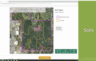
This short video walks potential users of Landmapper through the process of selecting a parcel within Oregon or Washington and creating a series of maps to help inform a forest management plan, gain access to information about their property, and connect to additional resources.
Want more information? See the related SARE grant:
This material is based upon work that is supported by the National Institute of Food and Agriculture, U.S. Department of Agriculture through the Sustainable Agriculture Research and Education (SARE) program. Any opinions, findings, conclusions, or recommendations expressed in this publication are those of the author(s) and should not be construed to represent any official USDA or U.S. Government determination or policy.